
Using advanced AI, geospatial intelligence technology can sift through massive satellite datasets to pinpoint specific details, even hidden ones. By combining multiple data sources and applying machine learning algorithms, you can quickly identify patterns, changes, or activities that might otherwise be missed. This automation reduces errors and speeds up analysis, enabling you to respond to threats or opportunities faster. Stay with us to discover how these powerful tools are revolutionizing how we interpret satellite imagery.
Key Takeaways
- Advanced AI algorithms analyze massive satellite datasets to automatically detect specific features or changes, like military activity or environmental shifts.
- Machine learning models identify subtle patterns and anomalies that are difficult for humans to spot in raw satellite imagery.
- Automated systems significantly accelerate data processing, enabling near real-time identification of critical “needles” in large data “haystacks.”
- Data integration enhances AI’s ability to cross-reference multiple sources, increasing detection accuracy and reducing false positives.
- Continuous technological advancements are making geospatial AI more precise and capable of uncovering hidden insights from vast satellite datasets.
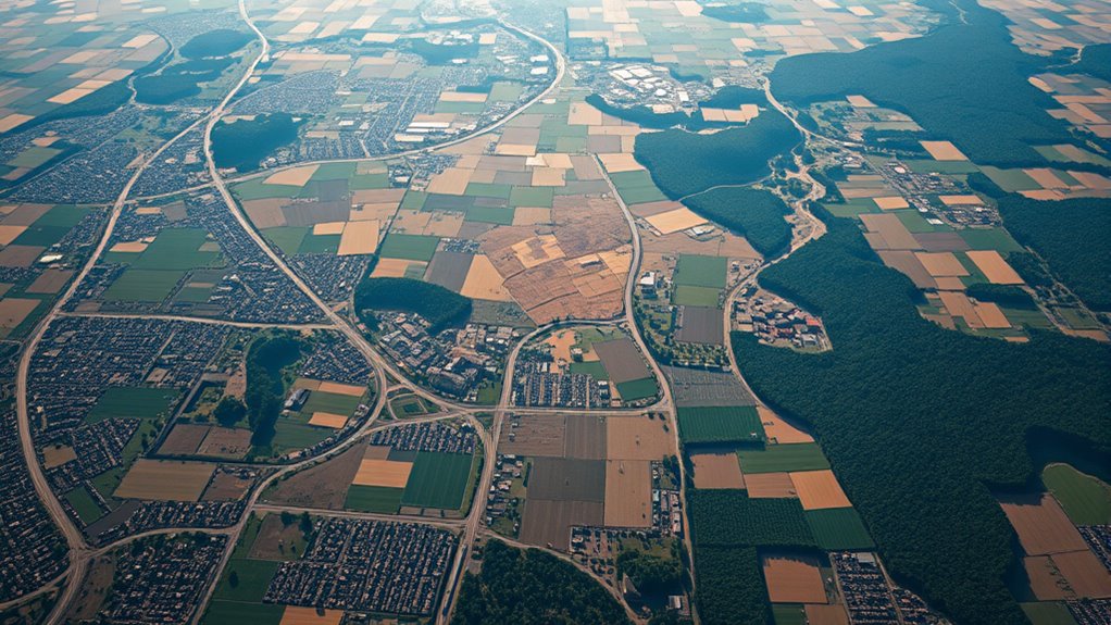
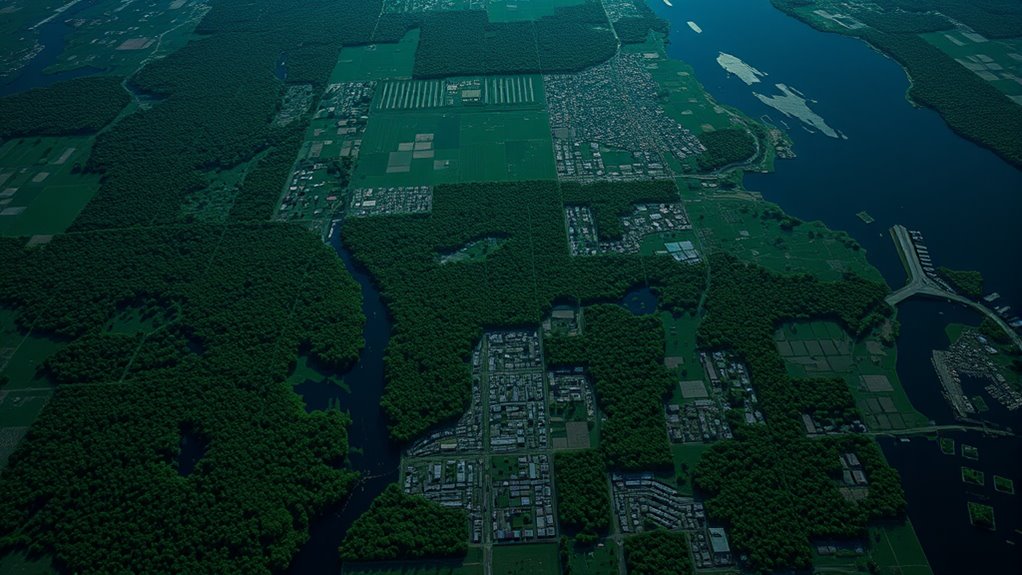
Have you ever wondered how governments and organizations gather critical information about the Earth’s surface? The answer lies in satellite analysis, a powerful tool that captures vast amounts of data from space. These satellites continuously orbit the planet, collecting imagery and sensor data that can reveal everything from urban development to environmental changes. But collecting data is just the first step. The real challenge is making sense of all that information, which is where data integration becomes essential. By combining data from multiple sources—optical images, radar, thermal sensors—you can create a comprehensive picture that highlights patterns, trends, and anomalies. This integrated approach allows you to analyze complex scenarios efficiently and accurately, giving decision-makers the insights they need in real-time.
Satellite analysis involves more than just capturing images; it’s about extracting meaningful information from the raw data. Advanced algorithms and machine learning models sift through terabytes of satellite imagery to identify specific features, such as new construction, deforestation, or military activity. These systems can detect subtle changes over time, providing early warning signs that might otherwise go unnoticed. When you combine this with data integration, you enhance your ability to cross-reference different datasets, increasing the reliability of your analysis. For example, overlaying thermal data with optical images can help identify hidden activities, like illegal mining or smuggling routes, that aren’t obvious from a single data source.
Advanced algorithms detect subtle changes in satellite data, revealing hidden activities through data integration.
This process of integrating diverse data streams also boosts the accuracy and depth of your insights. It allows you to construct layered maps and models that provide context for the raw satellite imagery. You can track how a city expands, monitor environmental degradation, or assess disaster impacts with a level of detail that was once impossible. The more sources you integrate, the better your understanding becomes, enabling proactive responses to emerging threats or opportunities. Plus, automated systems powered by AI make this data integration faster and more precise, reducing human error and increasing the speed at which actionable intelligence is generated. Additionally, understanding celebrity transformations can serve as a metaphor for how shifting data points reveal new insights, akin to how celebrities change appearance or circumstances over time.
In essence, satellite analysis combined with data integration transforms vast, complex datasets into clear, actionable intelligence. It’s like finding needles in a haystack—only now, with AI, you can locate those needles swiftly and accurately. This combo empowers organizations to make smarter decisions, whether for national security, environmental protection, or urban planning. As technology advances, so does your ability to harness satellite data, turning a seemingly overwhelming volume of raw information into a powerful tool for understanding and managing our world more effectively.

Imagery and GIS: Best Practices for Extracting Information from Imagery
As an affiliate, we earn on qualifying purchases.
As an affiliate, we earn on qualifying purchases.
Frequently Asked Questions
How Does AI Improve Real-Time Satellite Data Analysis?
AI improves real-time satellite data analysis by utilizing advanced image recognition to identify patterns and objects quickly. It also integrates diverse data streams seamlessly, providing a thorough view. You can process massive amounts of satellite imagery efficiently, enabling faster decision-making. This combination of image recognition and data integration helps you detect changes, monitor environments, and respond promptly to emerging situations, making your analysis more accurate and timely.
What Privacy Concerns Are Associated With Geospatial Intelligence?
Imagine walking through a city where your movements are constantly tracked—that’s the core of privacy concerns with geospatial intelligence. You might worry about data privacy and how your location data is stored or shared without consent. Surveillance ethics come into play, questioning whether it’s right for authorities or companies to monitor you. You need transparency about data use, ensuring your rights are protected against invasive surveillance practices.
Can Geospatial AI Predict Future Geographic Events?
Yes, geospatial AI can predict future geographic events through predictive modeling and event forecasting. You can analyze satellite data to identify patterns and trends that signal upcoming changes, like natural disasters or urban development. By leveraging real-time and historical data, this technology helps you anticipate events before they happen, enabling proactive decision-making. However, accuracy depends on data quality and algorithm sophistication, so predictions should be used alongside other information sources.
How Accessible Is Geospatial Intelligence Technology for Small Organizations?
Geospatial intelligence is more accessible than ever for small organizations, like opening a door to a treasure chest. Thanks to cloud accessibility and data democratization, you can now access powerful tools without huge investments. Cloud platforms provide affordable, scalable options, while open data initiatives make satellite imagery and geospatial data more available. This democratization empowers you to leverage AI-driven insights, turning satellite data into actionable intelligence without needing a big-budget operation.
What Are the Ethical Implications of Satellite Surveillance?
You should consider satellite ethics and surveillance privacy when evaluating satellite surveillance. It raises questions about individual rights, consent, and potential misuse of data. You might feel concerned about how your privacy could be compromised without your knowledge, and it’s important to advocate for regulations that protect citizens while allowing beneficial uses. Balancing security needs with privacy rights is essential to ensure responsible satellite technology deployment.

Geospatial AI (GeoAI) with Python Programming: Building Autonomous GIS Agents, Deep Learning Models, and Interactive Dashboards (Python & AI Masterclass)
As an affiliate, we earn on qualifying purchases.
As an affiliate, we earn on qualifying purchases.
Conclusion
As you harness the power of AI in geospatial intelligence, you’re wielding a mighty compass in a vast, uncharted ocean. It’s like finding a needle in a haystack, but with precision and speed you never thought possible. This technology transforms mountains of satellite data into clear, actionable insights, guiding your decisions with clarity. Embrace this innovation, and you’ll navigate the complexities of the world with the skill of a seasoned explorer, uncovering hidden truths beneath the surface.

DIY Satellite Platforms: Building a Space-Ready General Base Picosatellite for Any Mission
As an affiliate, we earn on qualifying purchases.
As an affiliate, we earn on qualifying purchases.

Remote Sensing for Geoscientists: Image Analysis and Integration, Third Edition
As an affiliate, we earn on qualifying purchases.
As an affiliate, we earn on qualifying purchases.