
You can see how geospatial intelligence turns images into decisions by analyzing satellite data in real-time, revealing patterns and risks you might miss otherwise. It uses advanced algorithms to identify key features like buildings, water, and vegetation, providing clear visual insights. This information helps you make informed choices about urban development, emergency response, and resource management. Keep exploring to discover how these tools can transform complex images into strategic actions you can trust.
Key Takeaways
- Utilizes advanced algorithms to analyze satellite images and identify relevant features like buildings, water, and vegetation.
- Integrates satellite data with GIS for layered analysis, revealing insights beyond traditional methods.
- Converts raw imagery into actionable information for decision-making in urban planning, disaster response, and resource management.
- Provides near-instant updates, enabling timely responses during emergencies and planning phases.
- Enhances understanding of spatial relationships, supporting strategic decisions with contextual clarity.
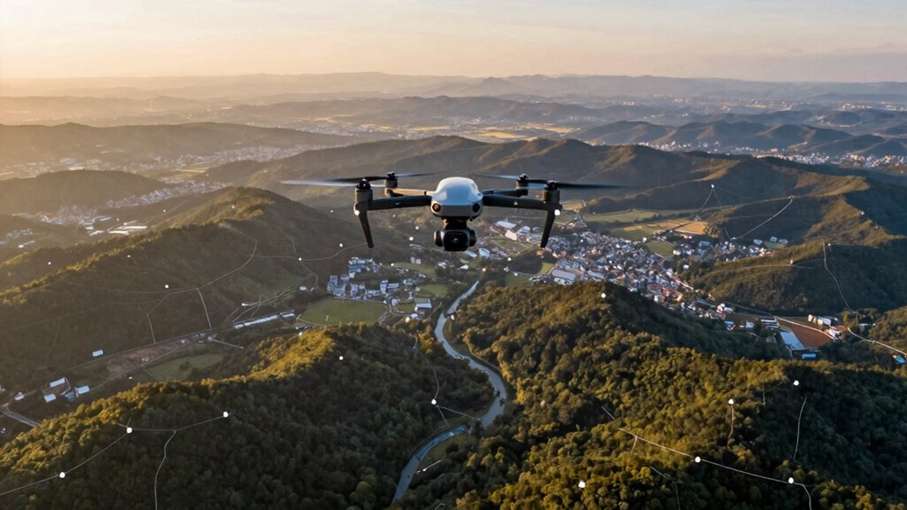
Have you ever wondered how governments and organizations make essential decisions quickly and accurately? The answer lies in the power of geospatial intelligence, which transforms raw imagery into actionable insights. With satellite analysis at its core, this technology provides a bird’s-eye view of the world, enabling decision-makers to see patterns, detect changes, and assess risks in real time. Whether managing natural resources, responding to emergencies, or planning urban growth, geospatial intelligence acts as a critical tool that turns complex images into clear, strategic decisions.
Geospatial intelligence transforms satellite imagery into real-time insights for smarter decision-making worldwide.
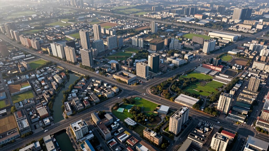
In urban planning, satellite analysis plays an important role. It offers detailed, up-to-date visuals of city landscapes, helping planners understand current land use, infrastructure development, and population density. Instead of relying on outdated maps or limited ground surveys, you can analyze high-resolution satellite images to identify areas for new roads, parks, or housing projects. This approach speeds up planning processes, reduces costs, and improves accuracy, ensuring that developments align with real-world conditions. Satellite data allows you to monitor urban sprawl, identify congestion points, and evaluate environmental impacts, supporting sustainable growth and smarter resource allocation.
The process begins with capturing satellite images that cover vast and often inaccessible regions. These images are then processed using advanced algorithms that highlight specific features, such as buildings, roads, bodies of water, or vegetation. By integrating this data with other geographic information systems (GIS), you can layer multiple datasets, revealing insights that might not be visible through traditional methods. For instance, during a disaster, satellite analysis can quickly identify affected areas, guiding rescue operations and resource distribution. In urban settings, it helps forecast future development needs by analyzing growth trends over time, giving you a clearer picture of where investments should go. Additionally, data integration enhances the robustness of these analyses, making the insights even more reliable.
Moreover, the immediacy of satellite analysis means you don’t have to wait for lengthy field surveys or reports. Instead, you get near-instant updates, allowing you to act swiftly in crises or planning phases. This rapid turnaround enhances your ability to make informed decisions, whether you’re coordinating emergency responses or designing a new transportation network. As urban populations grow and environmental challenges increase, the ability to leverage satellite analysis for urban planning becomes even more essential, ensuring that cities develop sustainably and efficiently. Incorporating advanced satellite technology further amplifies these capabilities, enabling more precise and comprehensive assessments. Additionally, understanding the underlying data processing techniques improves the interpretability and accuracy of the insights gained.
In addition, advancements in geospatial intelligence and data processing continue to expand the capabilities of satellite analysis, making it an even more powerful tool for decision-makers. In essence, geospatial intelligence turns complex satellite images into strategic decisions by providing clarity and context. It empowers you to see beyond the surface, understand spatial relationships, and respond proactively. With continuous advancements in satellite technology and data processing, your capacity to make accurate, timely decisions improves, making geospatial intelligence an indispensable asset in today’s fast-paced world.

Satellite Image Analysis: Clustering and Classification (SpringerBriefs in Applied Sciences and Technology)
As an affiliate, we earn on qualifying purchases.
As an affiliate, we earn on qualifying purchases.
Frequently Asked Questions
How Accurate Is Geospatial Intelligence in Real-Time Decision-Making?
Geospatial intelligence is highly accurate in real-time decision-making, thanks to advanced satellite technology and data validation methods. Satellite accuracy enables you to get detailed, current images, while rigorous data validation guarantees the information is reliable. You can trust this intel for critical decisions, as continuous improvements in satellite sensors and validation processes keep the data precise and timely, helping you respond swiftly and confidently to evolving situations.
What Are the Main Challenges in Interpreting Geospatial Data?
You often face challenges interpreting geospatial data because data accuracy can vary, impacting your analysis. Coincidentally, image analysis plays a vital role, but it’s often complicated by poor image quality, cloud cover, or outdated imagery. These issues make it difficult to extract precise insights quickly. Overcoming these challenges requires sophisticated tools and constant validation to guarantee your decisions are based on reliable, accurate geospatial information.
How Does Geospatial Intelligence Integrate With Other Data Sources?
You integrate geospatial intelligence with other data sources through data fusion, combining geospatial data with information from sensors, social media, or databases. This process enhances contextual analysis, enabling you to see the bigger picture and identify patterns or anomalies. By merging diverse data streams, you improve decision-making accuracy, respond faster to threats or opportunities, and create an all-encompassing understanding of the environment, ultimately turning raw images into actionable insights.
What Industries Benefit Most From Geospatial Intelligence?
Think of geospatial intelligence as a lighthouse guiding industries through foggy waters. You’ll find satellite imaging essential for sectors like urban planning, where it helps you visualize city growth and infrastructure needs. Industries such as agriculture, defense, and environmental management also benefit immensely. By turning satellite images into actionable insights, you can make smarter decisions, optimize resources, and stay ahead in a rapidly changing world.
How Is Privacy Preserved in Geospatial Intelligence Analysis?
You can preserve privacy in geospatial intelligence analysis through data anonymization and strict privacy protocols. By anonymizing data, you remove personal identifiers, ensuring individuals can’t be traced. Implementing privacy protocols, like access controls and encrypted data handling, further safeguards sensitive information. These measures help balance the valuable insights gained from geospatial data with respecting individual privacy rights, making sure analysis serves its purpose without compromising confidentiality.

Lindsey the GIS Professional (STEAM at Work!, 1)
As an affiliate, we earn on qualifying purchases.
As an affiliate, we earn on qualifying purchases.
Conclusion
By leveraging geospatial intelligence, you can transform raw images into actionable insights that drive smarter decisions. For instance, over 80% of military and humanitarian operations now rely on geospatial data to enhance accuracy and response times. This statistic highlights just how essential visual data analysis has become in critical situations. Embracing these technologies empowers you to make informed, timely choices, ultimately saving lives and resources in an increasingly complex world.
LAND-USE INFORMATION FROM THE SATELLITE IMAGERY: Versatility and Contents for Local Physical Planning
As an affiliate, we earn on qualifying purchases.
As an affiliate, we earn on qualifying purchases.

Space Systems for Disaster Warning, Response, and Recovery (SpringerBriefs in Space Development)
As an affiliate, we earn on qualifying purchases.
As an affiliate, we earn on qualifying purchases.