Satellite imagery alone rarely tells the whole story because clouds can block your view, making it hard to see what’s beneath. The images also have resolution limits, so small features might be missed. Plus, satellites provide only snapshots, not continuous changes, and high-resolution images can be costly and limited in coverage. Combining satellite data with ground or aerial info gives a fuller picture. If you want to understand these limitations better, keep exploring the details.
Key Takeaways
- Clouds obscure satellite views, leading to missed details and incomplete information.
- Resolution limitations prevent capturing fine-scale features or small changes.
- Satellite images provide only periodic snapshots, missing ongoing or rapid developments.
- Cost and coverage constraints limit the frequency and scope of high-resolution imagery.
- Additional ground-based and aerial data are necessary to achieve a comprehensive understanding.
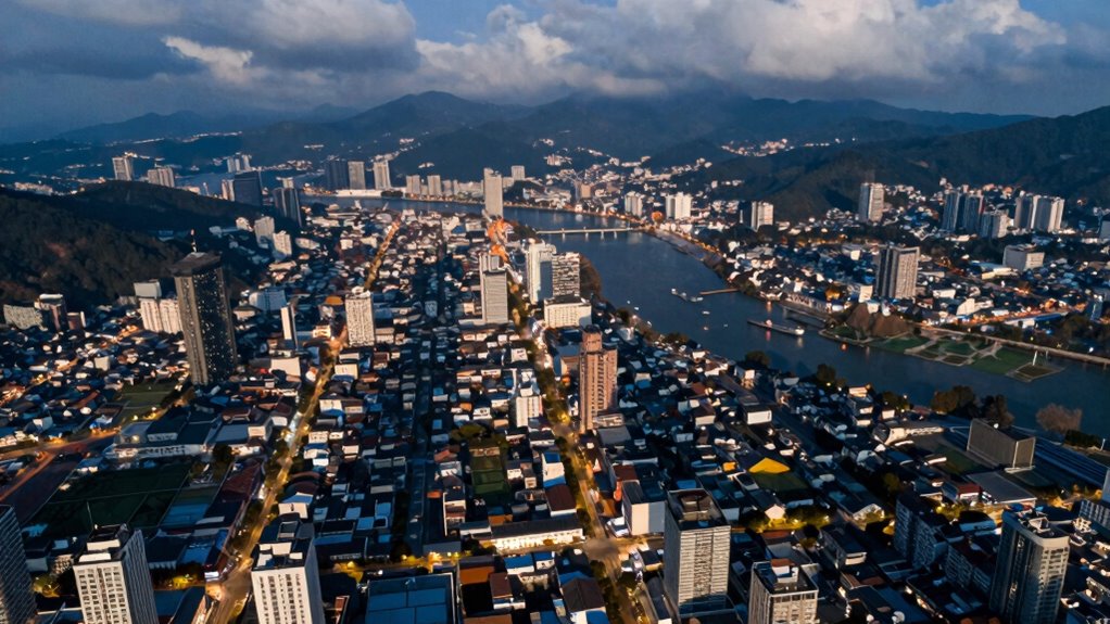
Satellite imagery has become an invaluable tool for monitoring the Earth’s surface, but it’s important to recognize its limitations. One major challenge is cloud cover, which can obscure the view of the ground and prevent you from getting clear images. When clouds block the satellite’s line of sight, it’s like trying to see through frosted glass—you simply don’t get a full picture. This means that, on cloudy days or in regions with frequent weather changes, your ability to monitor specific areas consistently is compromised. You might miss important details or changes happening underneath the clouds, making satellite images less reliable for real-time decision-making or detailed analysis.
Another critical factor to contemplate is resolution constraints. The resolution of satellite images determines the level of detail you can discern. Lower-resolution images may be sufficient for broad overviews, like tracking large-scale deforestation or urban expansion, but they lack the granularity needed for more precise assessments. For example, identifying small features such as individual buildings, narrow roads, or subtle signs of environmental stress becomes difficult or impossible at coarse resolutions. For many applications, the resolution of satellite images is a key consideration to ensure the data meets your specific needs. Conversely, high-resolution satellites can provide detailed imagery, but they often come with higher costs and limited coverage. This trade-off means you can’t always get the perfect balance of detail and coverage for your specific needs, which can hinder holistic analysis. Additionally, the cost of high-resolution satellites can limit their accessibility for many users.
Resolution limits can hinder detailed analysis, balancing cost, coverage, and detail is essential for effective satellite monitoring.
It’s also worth noting that satellite images are just a snapshot in time. The Earth’s surface is constantly changing—plants grow, erosion happens, construction progresses—and a single image can’t capture the full story. To truly understand environmental or urban developments, you need multiple images over time, but these are often limited by cloud cover and resolution constraints. Cloud cover can delay or limit the frequency of usable images, while resolution limitations restrict what details you can observe from each capture. As a result, relying solely on satellite imagery can give an incomplete or sometimes misleading picture, especially if you don’t deliberate on the timing and quality of the images. Temporal variability is another aspect to consider, as changes can occur rapidly or gradually, and without frequent updates, important developments might be missed. Incorporating ground-based data or aerial photography can provide additional context and help fill in the gaps left by satellite imagery, leading to more comprehensive analysis.
ground-based aerial imagery camera
As an affiliate, we earn on qualifying purchases.
As an affiliate, we earn on qualifying purchases.
Frequently Asked Questions
How Can Satellite Imagery Be Integrated With Other Data Sources?
You can integrate satellite imagery with other data sources through data fusion, combining different datasets to create a thorough view. Cross referencing satellite data with ground reports, sensor data, or social media helps verify and enrich insights. This approach improves accuracy, provides context, and captures details satellite imagery alone might miss. By actively blending these sources, you get a fuller, more reliable picture of the situation you’re analyzing.
What Advancements Are Improving Satellite Image Resolution?
Sharper, sleeker satellite snapshots are soaring thanks to stunning strides in remote sensing and image enhancement. Advanced sensors and algorithms now deliver dazzling detail, transforming blurry blobs into brilliant, high-resolution images. These technological tweaks allow you to see more clearly from space, revealing finer features and subtle shifts. As these innovations continue, satellite imagery becomes increasingly insightful, empowering you to make smarter, swifter decisions with stunning clarity and confidence.
How Do Weather Conditions Affect Satellite Imagery Accuracy?
Weather conditions, like cloud cover and atmospheric distortion, considerably impact satellite imagery accuracy. When clouds block the view, you can’t get clear images of the Earth’s surface. Atmospheric distortion, such as haze or turbulence, can blur details or shift colors, making analysis tricky. These conditions often require you to wait for better weather or use advanced sensors designed to penetrate clouds, but some details may still be compromised.
Can Satellite Images Detect Underground or Hidden Features?
Think of satellite images as a window into the Earth’s surface, but they can’t see beneath the skin. While they excel at revealing surface features, subsurface detection of hidden structures remains elusive with standard imagery. Specialized techniques like thermal imaging or radar can sometimes uncover buried features, but overall, satellite images alone can’t fully expose underground or concealed elements. You need other tools to reveal what lies beneath.
What Are the Privacy Concerns Related to Satellite Image Collection?
You should be aware that satellite image collection raises privacy concerns because it can lead to privacy violations by revealing sensitive information about individuals or private properties. This data collection also poses risks to data security, as unauthorized access or misuse of images can occur. As satellite technology advances, it’s essential to balance the benefits of imagery with protecting personal privacy and maintaining robust security measures.
high-resolution satellite image analysis software
As an affiliate, we earn on qualifying purchases.
As an affiliate, we earn on qualifying purchases.
Conclusion
Think of satellite imagery as a lighthouse’s beam—illuminating the coastline, but never revealing every hidden cove or underwater current. It guides you, yet leaves some depths unseen. To truly understand the landscape, you need more than just the light; you need a boat to explore beneath the surface. Remember, while satellites give you a vantage point, they can’t replace the depth of ground truth. Embrace both, and see the full picture clearly.
cloud-penetrating satellite sensors
As an affiliate, we earn on qualifying purchases.
As an affiliate, we earn on qualifying purchases.

Source-to-Sea Management (Routledge Special Issues on Water Policy and Governance)
As an affiliate, we earn on qualifying purchases.
As an affiliate, we earn on qualifying purchases.