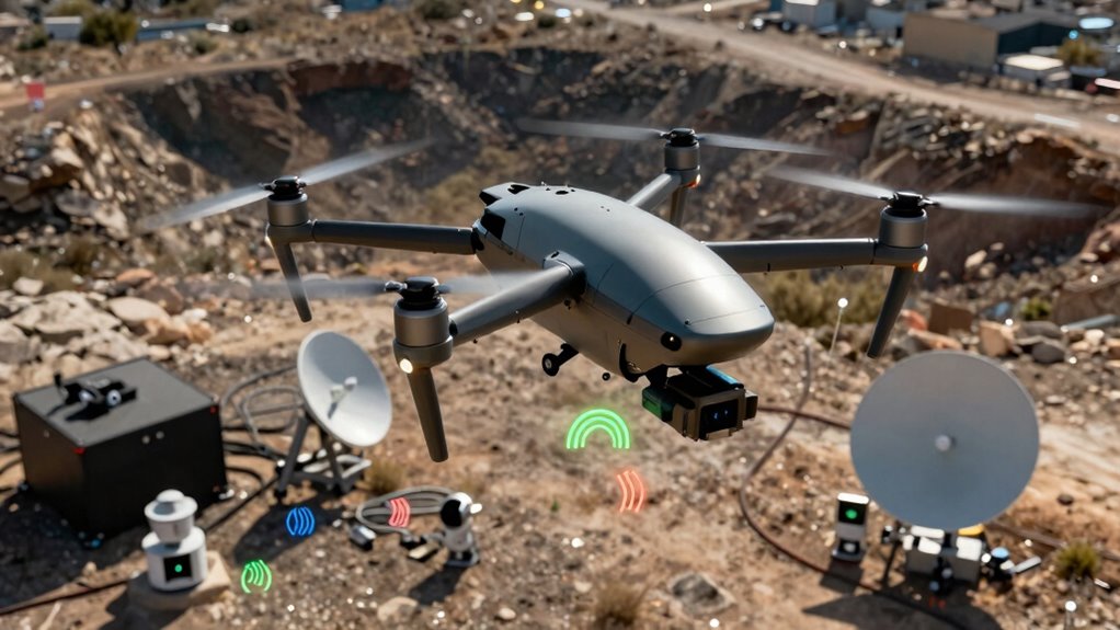
Aerial ISR platforms do more than just capture video. They combine radar, infrared, multispectral, and electro-optical sensors to create detailed, real-time images of the environment. They also intercept electronic signals and communications, providing signals intelligence. These platforms analyze heat signatures, atmospheric data, and terrain features, offering an all-encompassing picture of targets and conditions. If you want to explore how these systems enhance situational awareness even further, keep going.
Key Takeaways
- Collects signals intelligence (SIGINT), intercepting electronic communications and signals for strategic insights.
- Gathers multispectral and infrared data, detecting heat signatures and environmental conditions beyond visual spectra.
- Uses radar and electro-optical sensors to penetrate obscurants like fog, foliage, or darkness.
- Produces 3D terrain models and overlays for detailed spatial and environmental analysis.
- Monitors environmental parameters and chemical or biological agents for comprehensive situational awareness.

Have you ever wondered what modern aerial ISR platforms can do beyond capturing video? These advanced systems don’t just record moving images; they gather a vast array of data that provides an extensive picture of the environment. By leveraging sensor fusion and data integration, they transform raw signals into actionable intelligence. Sensor fusion combines inputs from different sensors—such as radar, infrared, multispectral, and electro-optical devices—creating a unified, detailed understanding of the scene. Instead of relying on a single sensor type, you get a layered perspective that enhances detection, identification, and tracking accuracy. This integration minimizes blind spots and compensates for individual sensor limitations, giving you a clearer picture even under challenging conditions like poor visibility or complex terrain. Additionally, the use of advanced data processing techniques allows for real-time analysis and more precise insights. Data integration is equally crucial. The information from these diverse sensors is processed and merged into a cohesive dataset, often in real time. This allows you to analyze movement patterns, detect anomalies, or identify objects that would be difficult to spot with video alone. For example, infrared sensors can reveal heat signatures, which are invaluable for night operations or covert surveillance, while radar can penetrate obscurants like fog or foliage. When you combine these data streams, you don’t just see a scene—you understand it. You can monitor the movement of vehicles, identify personnel, or track the spread of chemical or biological agents, all from a single platform. This multi-sensor approach enhances situational awareness, enabling faster, more accurate decision-making. Furthermore, the integration of sensor data with real-time analytics provides commanders with immediate insights, allowing for quicker responses to emerging threats. The use of multi-sensor data also helps to improve the robustness of intelligence by providing redundancy and cross-verification of information. Beyond these capabilities, aerial ISR platforms also collect signals intelligence (SIGINT), which includes intercepting electronic signals and communications. This broadens your intelligence scope, revealing intentions and activities that might otherwise go unnoticed. Additionally, they can gather imagery intelligence (IMINT) and measure environmental parameters, like atmospheric conditions or terrain features. The integration of all this data into a centralized system allows you to visualize complex scenarios holistically. You can overlay sensor data onto maps, generate 3D models, or run predictive analytics, making your assessments more robust and reliable. In essence, what these platforms collect goes far beyond traditional video footage. They compile a layered, multi-dimensional picture of the battlefield or operational environment. This all-encompassing intelligence supports better planning, faster response times, and more informed decisions. By harnessing sensor fusion and data integration, aerial ISR platforms become powerful tools that extend your operational reach, turning raw signals into strategic advantages.
aerial ISR sensor fusion systems
As an affiliate, we earn on qualifying purchases.
As an affiliate, we earn on qualifying purchases.
Frequently Asked Questions
What Types of Sensors Complement Video Data on ISR Platforms?
You complement video data on ISR platforms with sensors like multispectral analysis tools and synthetic aperture radar (SAR). Multispectral sensors capture data across various wavelengths, revealing details invisible to the naked eye, like vegetation health or camouflage. SAR provides high-resolution images through cloud cover and darkness, offering detailed terrain mapping. Together, these sensors give you an all-encompassing understanding of the environment, enhancing intelligence collection beyond just visual imagery.
How Is Collected Data Processed in Real-Time?
You might think real-time data processing is straightforward, but in reality, it’s complex. When you gather data from multiple sensors, data integration happens instantly, combining diverse inputs for a thorough picture. Analytical algorithms then analyze this integrated data on the fly, filtering out noise and highlighting critical details. This rapid processing allows you to make immediate decisions, ensuring your ISR platform provides actionable intelligence without delay.
What Are the Limitations of Aerial ISR Platforms?
You face limitations with aerial ISR platforms, such as sensor calibration challenges that can affect data accuracy. Data redundancy issues may occur if multiple sensors capture overlapping information, leading to inefficiencies. Additionally, environmental factors like weather or terrain can hinder data collection. These constraints require careful planning and regular maintenance to guarantee reliable operation, but they can still impact the overall effectiveness of airborne intelligence, surveillance, and reconnaissance missions.
How Is Data Security Maintained During Transmission?
Think of your data as a treasure chest being carried across treacherous waters. You guarantee its safety with encryption protocols, like a magical lock that only trusted parties can open. To maintain data integrity, you check for signs of tampering, like a vigilant captain inspecting the ship. This way, during transmission, your sensitive information stays secure, unaltered, and accessible only to authorized recipients.
What Future Technologies Will Enhance ISR Capabilities?
Future ISR capabilities will be greatly enhanced by artificial intelligence and sensor fusion. AI will enable real-time data analysis, quick decision-making, and autonomous operation, reducing human workload. Sensor fusion combines data from multiple sources, providing all-encompassing situational awareness and improving target identification accuracy. Together, these technologies will make aerial ISR platforms smarter, faster, and more effective in complex environments, ensuring you get more actionable intelligence with less delay.
Conclusion
So, next time you see an aerial ISR platform capturing only video, remember—it’s probably doing much more. While it’s easy to assume its sole purpose is surveillance, these platforms secretly collect a treasure trove of data beyond what meets the eye. Ironically, what seems like simple footage might actually be part of a complex web of intelligence. In the end, what you see isn’t always what’s truly being gathered—just like a magician’s trick, there’s more than meets the eye.