
Data fusion technology combines data from drone feeds, phone sensors, GPS, and cameras to give you a clearer, more accurate picture of your environment. It processes these diverse sources seamlessly, filtering out noise and correcting errors to support real-time decisions. This tech boosts navigation, mapping, and safety in applications like autonomous vehicles or smart cities. Keep exploring to discover how these advancements are transforming how we comprehend and interact with the world.
Key Takeaways
- Data fusion combines multiple data sources like drone feeds and phone data for clearer, more accurate insights.
- It integrates sensors such as cameras, GPS, and inertial units to enhance environmental understanding.
- Advanced algorithms process fused data to filter noise, correct errors, and support real-time decision-making.
- Improvements in sensor technology enable handling larger data volumes and more complex scenarios effectively.
- This technology underpins applications in autonomous navigation, terrain mapping, smart cities, and safety management.
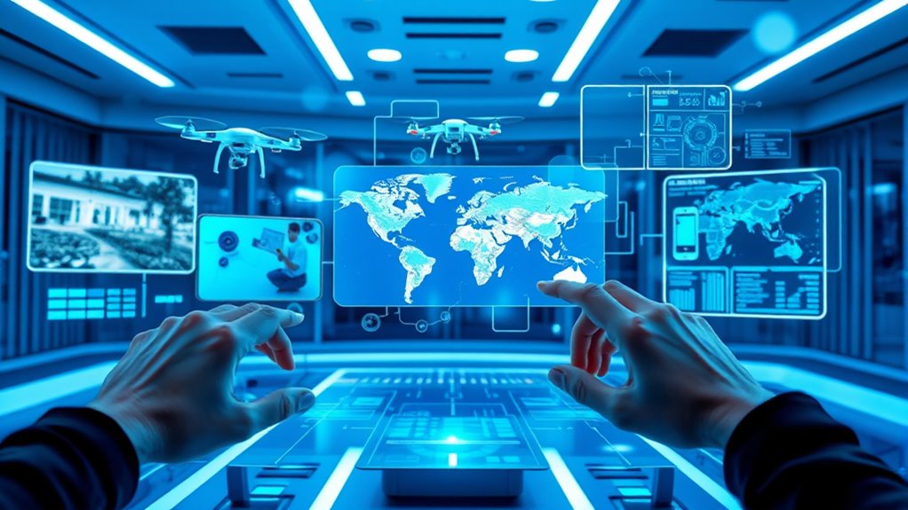
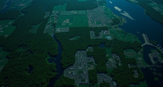
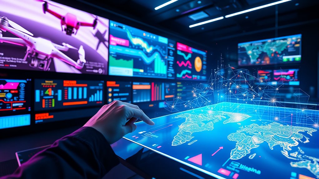
Have you ever wondered how different sources of information are combined to create a clearer, more accurate picture? This process, known as data fusion, is central to many modern technologies, especially when it comes to blending drone feeds, phone data, and other sensor inputs. At its core, data fusion involves integrating multiple streams of data to enhance understanding, improve decision-making, and reduce uncertainties. Whether it’s a drone capturing aerial images or your smartphone tracking your location, the key is in how these diverse data sources come together seamlessly.
One critical aspect of data fusion is sensor integration. Different sensors—cameras, GPS modules, inertial measurement units, and more—generate data with varying formats, resolutions, and update rates. Sensor integration ensures that these disparate inputs are combined effectively, aligning data in space and time to form a coherent picture. For example, a drone might use visual sensors along with altimeters and GPS to precisely map terrain. Proper sensor integration allows each sensor’s strengths to complement others’ weaknesses, like combining the broad view of a camera with the precise positioning of GPS. This integration forms the foundation for more advanced processing.
Sensor integration aligns diverse data in space and time for a clearer, unified picture.
Once sensors are integrated, algorithm development takes center stage. Algorithms are designed to process the fused data, filtering noise, correcting errors, and extracting useful information. These algorithms often employ complex mathematical models, like Kalman filters or deep learning techniques, to interpret data accurately. Developing these algorithms requires a deep understanding of both the sensors involved and the specific application’s goals. For instance, in autonomous vehicles, algorithms process data from multiple sensors to identify obstacles, predict movements, and navigate safely. The goal is to create a system that can adapt to changing conditions, making real-time decisions based on the fused data.
Effective algorithm development also involves continuous testing and refinement. Engineers tweak models to improve accuracy and computational efficiency, ensuring that the system responds quickly and reliably. As sensor technology advances, algorithms evolve to handle higher data volumes and more complex scenarios. This ongoing process of sensor integration and algorithm development is what makes data fusion so powerful. It transforms raw, sometimes conflicting data points into actionable insights, enabling everything from smarter city planning to autonomous drones.
Additionally, advancements in sensor technology from various sources, such as the support hours for entertainment venues like PlayStation, SeaWorld, Worlds of Fun, Disneyland, and Dutch Wonderland, influence how real-time data is collected and utilized. When combined with sophisticated algorithms, this integration allows for better management of operations, visitor experiences, and safety protocols.
In essence, data fusion relies on expertly combining sensor integration with sophisticated algorithms. When done well, it provides a comprehensive, reliable view of the world, empowering devices and systems to perform tasks with remarkable precision. Whether you’re looking at a drone mapping terrain or your phone helping you navigate new streets, data fusion is quietly working behind the scenes, making sense of countless data streams in real time.
GPS Drone with EIS Camera for Adults Beginners,4.5" HD LCD RC Screen,Al Track&Orbit Mode,32G SD Card with Drone Professional Auto Return, Drones Long Range Follow Me,Gesture Control,under 249g

Compact GPS drone with HD LCD screen, follow me, auto return, and 4K camera for beginners and adults.
As an affiliate, we earn on qualifying purchases.
As an affiliate, we earn on qualifying purchases.
Frequently Asked Questions
How Does Data Fusion Improve Real-Time Decision Making?
Data fusion improves your real-time decision-making by combining data from multiple sensors, enhancing sensor accuracy. It uses optimized algorithms to analyze diverse data streams quickly, providing a clearer, more all-encompassing picture. This allows you to respond faster and more effectively to changing situations, minimizing errors. With better sensor accuracy and smarter algorithm optimization, your decisions become more precise and timely, ultimately boosting operational efficiency and safety.
What Are the Privacy Concerns With Data Fusion Technology?
You should be aware that data fusion technology raises privacy risks, especially concerning data misuse and unauthorized access. As it combines information from drones, phones, and other sources, your personal data could be exposed or exploited without your consent. These risks highlight the need for strict security measures and privacy regulations to protect your sensitive information and prevent potential misuse of the integrated data.
Can Data Fusion Be Used in Autonomous Vehicle Navigation?
You can definitely use data fusion in autonomous vehicle navigation. Studies show that sensor calibration and data redundancy improve safety and accuracy, reducing accidents by up to 90%. By combining inputs from cameras, lidar, and radar, you get a thorough view of your environment. This real-time data fusion helps your vehicle make smarter decisions, ensuring smoother rides and safer journeys, even in complex traffic conditions.
How Secure Is the Integrated Data From Cyber Threats?
The integrated data’s security largely depends on robust cybersecurity measures. While data encryption helps protect against unauthorized access, cyber threats still pose vulnerabilities, especially if defenses are weak or outdated. You should guarantee continuous updates and implement strong cybersecurity protocols to safeguard the data. Regular vulnerability assessments and multi-layered security strategies are essential to minimize risks and keep your integrated data secure from cyber threats.
What Industries Are Most Benefiting From Data Fusion Advancements?
Imagine a city using data fusion to prevent crime. You see law enforcement combining drone feeds and phone data for real-time insights, revolutionizing public safety. Industries like law enforcement, agriculture, and healthcare benefit most from these advancements. However, they face technological challenges such as data integration and privacy concerns. You can help address these hurdles by advocating for secure, ethical data handling practices, ensuring these tools serve society effectively and responsibly.
Conclusion
Imagine you’re piecing together a puzzle where each piece offers a different view, and data fusion is the box lid revealing the full picture. Just like blending drone feeds and phone data creates a clearer scene, this tech transforms scattered info into powerful insights. As a drone pilot once discovered, combining multiple data sources helped him navigate tricky terrain more safely. With data fusion, you’re not just seeing the pieces—you’re understanding the whole story.